On Othoni, you experience the island at a different pace. Walking its paths, you notice things you would normally miss the scent of the sea carried inland, the quiet between villages, the feeling of moving without hurry.
The island’s network of historic footpaths once connected daily life villages, farmland, and the coast. Today, they are maintained by the municipality and local volunteers, preserving both access and heritage.
Exploring these paths is not just about reaching a destination. It’s about the simplicity of being outside, where time slows down that makes this experience unique.
Ammos – Chorio Path
This historic stone path (kalderimi) connects Ammos with Chorio. The route is about 2.7 km, mostly uphill, and takes 45–60 minutes.
Along the way, you walk through cypress, olive, and chestnut trees, with shaded sections and places to rest. Midway, you pass through Argyratika, where small landmarks like the old school and the Cross Monument reflect the island’s past.
It’s a route that locals once used every day, and it still carries that sense of connection.
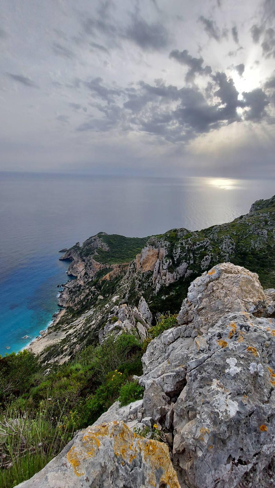
Imerovigli
A signposted trail near Chorio leads to Imerovigli, the highest point of Othoni (393 m). The 1.2 km climb is moderately challenging, with rocky sections and open terrain.
At the top, the view opens completely the island below, the Ionian and Adriatic Seas, and on clear days, the coast of Italy.
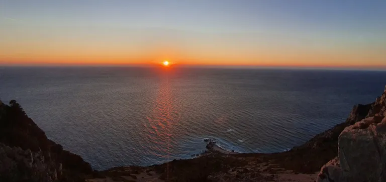
Sunset Viewpoints
Sunset on Othoni is something you should not miss. As the light fades over the Adriatic, everything slows down.
Near Chorio, two paths lead to viewpoints:
- A short paved path to a small amphitheater above Xilosemri Beach, with benches and safety barriers.
- A quieter trail along an unpaved road leading to the cliffs, more exposed and less visited.
Both offer wide, open views of the horizon, where the day ends without noise or distraction.
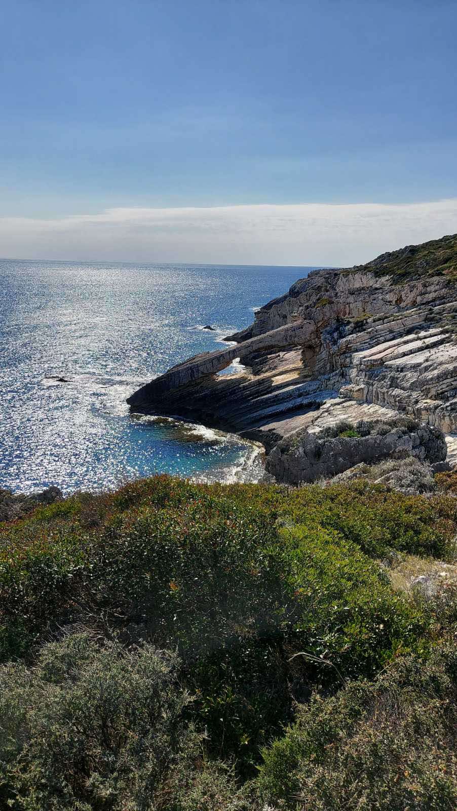
Fokies Path
Named after the Mediterranean monk seal (Monachus monachus), this coastal path is about 1 km long and of moderate difficulty.
Starting near the old quarry, it follows the shoreline, with views of cliffs and the open sea. Along the way, you reach Kamares, a natural rock arch shaped by the water, and small access points where you can stop for a swim.
Kanoula Trail – Lighthouse & Venetian Fortress
This short route connects Kastri with Kanoula Beach. You can walk from Ammos (about 3 km) or start from Kastri.
The trail passes the Kastri Lighthouse (1872) and the remains of a small Venetian fortress before reaching Kanoula Beach, a quiet cove known for its clear waters and natural clay.
Some parts of the path can be narrow or overgrown, so proper footwear is recommended.